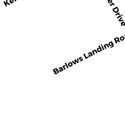
369 BARLOWS LANDING RD
Owner Information
BAXLEY GROVER G
PO BOX 5
CATAUMET, MA 02534-0005


Property Details
369 BARLOWS LANDING RD is classified as a Small Retail and Services stores (under 10,000 sq. ft.) (Restaurant).
The primary structure on this property was built in 1956. There are 3,290ft2 of built area within this property. There is 3,290ft2 of residential/living space within this property.
369 BARLOWS LANDING RD is valued at $426,600. The land is valued at $264,300 and the structures are valued at $147,100. There is an additional valuation of $15,200 on this property.
The most recent deed for 369 BARLOWS LANDING RD is recorded at the local registrar in Book 27952, Page 311. 369 BARLOWS LANDING RD was last sold on Friday, January 24, 2014 for $1.
Assessment data from fiscal year 2020.
Flood Data
According to the FEMA National Flood Hazard Layer, this property does not appear to be in a flood zone. It may also be in an area not yet reviewed. Nonetheless, confirm this information prior to taking any action.
To view the flood hazards around this property, create a FEMA "Firmette" Map of the area around 369 BARLOWS LANDING RD.
Broadband Internet Providers
| Provider | Type | Bandwidth (mbps) | |
|---|---|---|---|
| Verizon New England Inc. | DSL | 7 | 0 |
| Comcast | Cable | 1000 | 35 |
| GCI Communication Corp. | Satellite | 0 | 0 |
| HughesNet | Satellite | 25 | 3 |
| VSAT Systems, LLC. | Satellite | 2 | 1 |
| Viasat Inc | Satellite | 35 | 3 |
Broadband service provider data from December 2020.
Adjacent Properties
- 857 SHORE RD
Residential Condominium owned by ZUNINO MARY M ETUX - 857 SHORE RD
IMPUTED - Office Condo Bldg owned by FOLEY DONALD P & - 857 SHORE RD
IMPUTED - Office Condo Bldg owned by ZUNINO MARY M ETUX - 857 SHORE RD
IMPUTED - Office Condo Bldg owned by MCLAUGHLIN M ELEANOR - 365 BARLOWS LANDING RD
Small Retail and Services stores (under 10,000 sq. ft.) owned by PATEL HARSHADKUMAR K TRS - 871 SHORE RD
Housing Authority owned by BOURNE HOUSING AUTHORITY